Maps are a great tool to help kids learn about geography. This cartoon map itself shows the Continents, Sea and Ocean names with hill and sea shading. Major landmarks like Victoria Falls or Mount Everest are also seen on the map. You can add this to your kid’s playroom or study room as a fun element.
Kids will love the scene of Polar Bears playing and the Aborigines dancing to the didgeridoo on this cartoon map.
Buy This Map For Your Kids
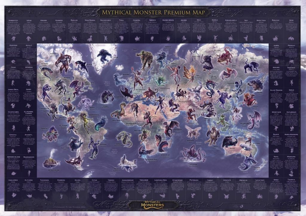
Mythical Monster Map
From $23.07
Kids Physical World Education Map
From $32.30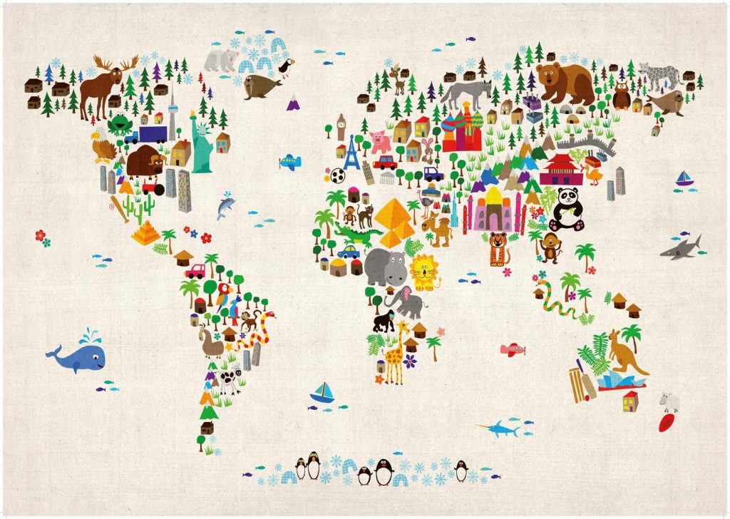
Kids Animal Map
From $21.53
