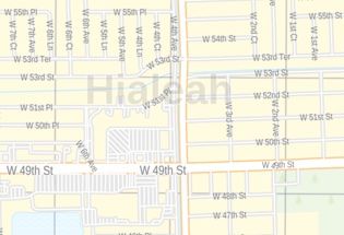
Hialeah FL, Map
This map of Hialeah City has been designed with accuracy based on well-researched data. Transportation routes (I-75,I-95, U.S-27, SR-25, SR-826) interlinking Cities of Florida, USA are marked neatly in the map with color-coded markings. The map shows Municipal, town and ZIP code boundaries.
Details on the Map
The map has been designed to make custom maps suitable from City to County Scales, and anywhere in between. The map also highlights high-level land use like parks (Milander Park), recreation areas, industrial areas, and hospital campuses, Government Buildings, and more. Major infrastructure like airports, police stations, shopping malls, industrial complexes, train stations is also identifiable. Railways, ferry routes, landmarks, and a variety of major points of interest are included in the map.
The customizable map is available in landscape and portrait orientation. The title of your choice can also be added to the map. A map legend at the bottom helps identify all signs and symbols used on the map.
Uses of Map
The map displayed in different colors makes an attractive wall display in offices, educational institutions, business centers, and home study. The product is ideal for the business owner who needs a local or regional road network information within a service delivery, catchment area or a sales territory. The detailed road networks make this map an ideal tool for general reference and planning long-distance trips. The map's explanatory nature is clear and graspable which makes it apt for business, travel, and reference use.
Facts and Figures of Hialeah, Florida
- Latitudinal and longitudinal Coordinates-27.46’23” N 82.38’24” W
- Elevation- 7 ft (2 m)
- Total Area-22.82 sq miles(59.09 km2)
- Total Land Area-21.58 sq miles (55.90 km2)
- Total Water Area-1.24 sq miles (3.20 km2)
More information about Hialeah, Florida
Hialeah is a city in Miami-Dade County, Florida, United States. Hialeah is the Sixth-largest City in Florida. It is a principal city of the Miami metropolitan area. Hialeah is located west-northwest of Miami, and is the only place in the county, other than Homestead, Florida, to have its own street grid numbered separately from the rest of the County. Hialeah is served by the Miami Metrorail at Okeechobee, Hialeah, and Tri-Rail/Metrorail Transfer stations.
The economy of Hialeah, Florida
The city of Hialeah is a significant commercial center in Miami-Dade County. The city is host to national retailers such as Starbucks, Target, Best Buy, Walmart, Lowe’s and The Home Depot, as well as homegrown businesses such as Navarro and Sedano’s. Hialeah is also home to a vibrant community of mom-and-pop stores. The new electronics and technology businesses have reinvigorated the local economy over time.
Surrounding Areas near Hialeah, Florida
- North-Unincorporated Miami-Dade County, Miami Lakes, Opa-Locka, Westview
- West-Hialeah Gardens, Medley, Miami Springs
- East-West little River, Gladeview, Brownsville, Miami
- South- Hialeah Gardens, Medley, Miami springs
Zip and Area Codes Hialeah, Florida
The Hialeah roughly covers 10 ZIP codes in total. The Zip code of the city ranges from 33002,33010-33018. The Area codes of the City are 305 and 786.
More Maps Of Florida Cities
| SKU | svd_fl_hialeah_36 |
|---|---|
| Map Scale | 1:14k |
| Flat Size | 36 x 48 in |

-
![Miami Gardens ZIP Code Map, Florida]() Miami Gardens ZIP Code Map, FloridaPrice from $41.99
Miami Gardens ZIP Code Map, FloridaPrice from $41.99 -
![Hialeah ZIP Code Map, Florida]() Hialeah ZIP Code Map, FloridaPrice from $41.99
Hialeah ZIP Code Map, FloridaPrice from $41.99 -
![Doral ZIP Code Map, Florida]() Doral ZIP Code Map, FloridaPrice from $41.99
Doral ZIP Code Map, FloridaPrice from $41.99 -
![Doral Map]() Doral MapPrice from $79.99
Doral MapPrice from $79.99 -
![Miami FL, Map]() Miami FL, MapPrice from $32.99
Miami FL, MapPrice from $32.99 -
![Miami Gardens FL, Map]() Miami Gardens FL, MapPrice from $24.99
Miami Gardens FL, MapPrice from $24.99