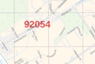
Oceanside Map
An interactive Oceanside map shows street details with clearly marked landmarks, government buildings, schools, churches, important routes, highways (I-5, SR-76, SR-78), and more. The map also highlights Municipal, Town, and Zip code boundaries. The map also depicts hospital campuses, postal districts, streets and neighborhoods, industrial areas, and recreation areas like parks, Golf courses, Hotels, and much more.
Major infrastructure like airports/(Oceanside Municipal airport), police stations, shopping malls, industrial complexes, train stations is also identifiable. A map legend featured at the bottom helps all the signs, characters graphics, and symbols used throughout the map.
About Oceanside, California
Oceanside is a Coastal City located on California’s South Coast in San Diego County. Together with Carlsbad and Vista, it forms a tri-city area. Oceanside is located just south of Marine Corps Base Camp Pendleton. Traveling north on Interstate 5, Oceanside is the last city before Orange County.
Major Attractions in Oceanside, California
The major attractions in Oceanside, California include:
- The Oceanside Pier
- The Historic District of Mount Ecclesia
- The California Surf Museum is located in downtown Oceanside
- The Oceanside Transit Center
More maps of California Cities
| SKU | svd_ca_oceanside_24 |
|---|---|
| Map Scale | 1:12,000 |
| Flat Size | 24 x 36 in |


-
![Oceanside ZIP Code Map, California]() Oceanside ZIP Code Map, CaliforniaPrice from $41.99
Oceanside ZIP Code Map, CaliforniaPrice from $41.99 -
![Carlsbad ZIP Code Map, California]() Carlsbad ZIP Code Map, CaliforniaPrice from $41.99
Carlsbad ZIP Code Map, CaliforniaPrice from $41.99 -
![Escondido ZIP Code Map, California]() Escondido ZIP Code Map, CaliforniaPrice from $41.99
Escondido ZIP Code Map, CaliforniaPrice from $41.99 -
![Camp Pendleton ZIP Code Map, California]() Camp Pendleton ZIP Code Map, CaliforniaPrice from $41.99
Camp Pendleton ZIP Code Map, CaliforniaPrice from $41.99 -
![Del Mar ZIP Code Map, California]() Del Mar ZIP Code Map, CaliforniaPrice from $41.99
Del Mar ZIP Code Map, CaliforniaPrice from $41.99 -
![Escondido Map]() Escondido MapPrice from $24.99
Escondido MapPrice from $24.99