Boca Raton Map
A Self Explanatory Boca Raton map shows street details with marked landmarks, museums (costume museum), government buildings, schools, churches, major routes, highways (I-95, U.S-441, SR-A1A), and more. The map also depicts hospital campuses, postal districts, streets and neighborhoods, industrial areas, and recreation areas like parks (Spanish River Park), Golf courses, Hotels and much more.
Major infrastructure like schools and colleges (Florida Atlantic University) airports, police stations, sports complexes, shopping malls (Town Center Mall), train stations are also identifiable. A map legend featured at the bottom helps all the signs, characters graphics, and symbols used throughout the map.
About Boca Raton, Florida
Boca Raton is the Southernmost City in Palm Beach County, Florida, United States.known as one of the wealthiest cities in south Florida with common sights of Yacht, Private jets, exotic cars, and mansions which are concentrated in the Downtown, Coastal, and Gated Country Club Communities.
With a multitude of amenities such as golf, tennis, racquetball, polo, swimming pools, spas, gyms, and restaurants, Boca Raton has been consistently highly ranked for fitness and leisure. Boca Raton is 43 miles (69 km ) north of Miami.
- Bergeron Rodeo Grounds
- Davie School
- Flamingo Gardens
- Young at Art Museum
- Pine Island Ridge
More Maps Of Florida Cities
| SKU | svd_fl_boca_raton_24 |
|---|---|
| Map Scale | 1:21,000 |
| Flat Size | 24 x 36 in |

-
![Boca Raton ZIP Code Map, Florida]() Boca Raton ZIP Code Map, FloridaPrice from $41.99
Boca Raton ZIP Code Map, FloridaPrice from $41.99 -
![Coconut Creek ZIP Code Map, Florida]() Coconut Creek ZIP Code Map, FloridaPrice from $41.99
Coconut Creek ZIP Code Map, FloridaPrice from $41.99 -
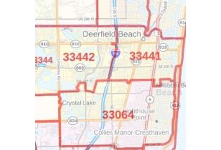
![Deerfield Beach ZIP Code Map, Florida]() Deerfield Beach ZIP Code Map, FloridaPrice from $41.99
Deerfield Beach ZIP Code Map, FloridaPrice from $41.99 -
![Deerfield Beach FL, Map]() Deerfield Beach FL, MapPrice from $24.99
Deerfield Beach FL, MapPrice from $24.99 -
![Delray Beach FL, Map]() Delray Beach FL, MapPrice from $24.99
Delray Beach FL, MapPrice from $24.99 -
![Coconut Creek FL, Map]() Coconut Creek FL, MapPrice from $24.99
Coconut Creek FL, MapPrice from $24.99