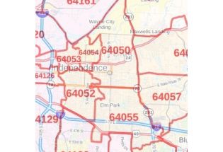
Blue Springs, MO Map
Map of Blue Springs, Missouri uses the base map data from TomTom. The data is updated every 6 months making this one of the most updated printed large map of Blue Springs, MO and its neighborhood areas.
This map is available in a scale of 1:15,000 in 36 x 24 inches. If you want a map with different extents, orientation, or scale, you can do that by customizing the map here.
If you have any questions, we will be happy to answer over the phone (866) 525-2298 or write to us
This map is available in 24 x 36 in. Please select a finish of your choice
Please wait, adding to your cart
Please wait, initializing the product
.
| SKU | svd_mo_blue_springs_36 |
|---|---|
| Map Scale | 1:15,000 |
| Flat Size | 24 x 36 in |
Write Your Own Review
Nearby Locations
-
![Kansas City, Missouri Inner Metro - Landscape Map]() Kansas City, Missouri Inner Metro - Landscape MapPrice from $39.99
Kansas City, Missouri Inner Metro - Landscape MapPrice from $39.99 -
![Kansas City, Missouri Inner Metro - Portrait Map]() Kansas City, Missouri Inner Metro - Portrait MapPrice from $39.99
Kansas City, Missouri Inner Metro - Portrait MapPrice from $39.99 -
![Independence ZIP Code Map, Missouri]() Independence ZIP Code Map, MissouriPrice from $41.99
Independence ZIP Code Map, MissouriPrice from $41.99 -
![Blue Springs ZIP Code Map, Missouri]() Blue Springs ZIP Code Map, MissouriPrice from $41.99
Blue Springs ZIP Code Map, MissouriPrice from $41.99 -
![Independence, MO Map]() Independence, MO MapPrice from $32.99
Independence, MO MapPrice from $32.99 -
![Lee's Summit, MO Map]() Lee's Summit, MO MapPrice from $24.99
Lee's Summit, MO MapPrice from $24.99