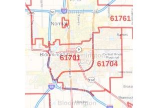
Peoria County Zip Code Map, Illinois
This is a detailed Peoria County Zip Code Map, Illinois showing various Zip codes in the area. It marks all 5 digit Zip code areas using red boundaries overlaid on the road map. Railways, major roads (I-74, I-474, US-24, US-150, and more) high-level land use such as parks and recreation areas, industrial areas, postal districts Airports (General Wayne A. Downing Peoria International Airport), and hospital campuses are mentioned in a detailed scale.
This map is available in a scale of 1:35,000 in 48 x 36 inches in landscape orientation. If you want a map with different extents, or portrait orientation, or scale, you can do that by customizing the map here. If you have any questions, we will be happy to answer over the phone (866) 525-2298 or write to us