South Central United States Map - Published 1947
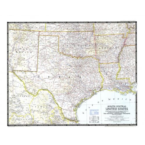
The fifth in a series of six sectional maps of the U.S., the South Central United States map was published in December 1947 and includes the states of Texas, Oklahoma, Arkansas, Louisiana, Mississippi, and much of New Mexico. This map series was printed between 1940 and 1948.
Details
The fifth in a series of six sectional maps of the U.S., the South Central United States map was published in December 1947 and includes the states of Texas, Oklahoma, Arkansas, Louisiana, Mississippi, and much of New Mexico. This map series was printed between 1940 and 1948.
More Information
| SKU | ngmaps-HM19471200-1 |
|---|---|
| Flat Size | 31.25 x 24.75 in |
| Publication Date | 1947 |
| Publisher Name | National Geographic |
Reviews
{{title}}
{{detail}}
No reviews yet ...
Have an opinion? Help others decide. Share your knowledge about this product by submitting a review.
{{/items}}
{{#previousPage}}
Previous Page
{{/previousPage}}
{{#load-more-src}}
Next Page
{{/load-more-src}}
★★★★★
★★★★★