Southeastern United States Map - Published 1947
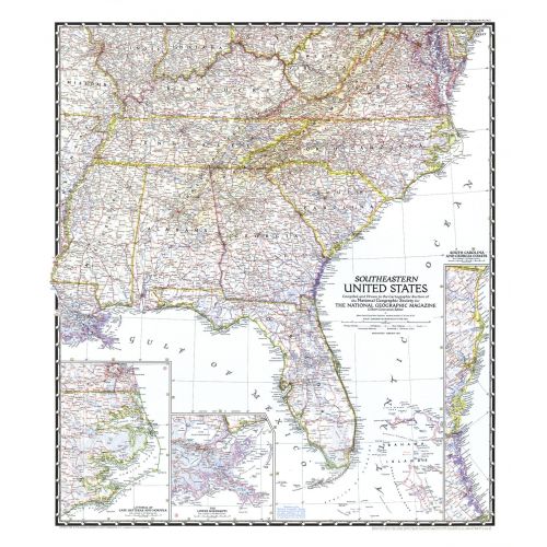
The Southeastern United States map appeared in National Geographic Magazine in February 1947. Particular attention is paid to the Atlantic coastlines with insets of the South Carolina and Georgia coasts, and Cape Hatteras and Norfolk. It also features an inset of the lower Mississippi region including New Orleans.
Details
The Southeastern United States map appeared in National Geographic Magazine in February 1947. Particular attention is paid to the Atlantic coastlines with insets of the South Carolina and Georgia coasts, and Cape Hatteras and Norfolk. It also features an inset of the lower Mississippi region including New Orleans.
More Information
| SKU | ngmaps-HM19470200-1 |
|---|---|
| Flat Size | 27.25 x 31.5 in |
| Publication Date | 1947 |
| Publisher Name | National Geographic |
Reviews
{{title}}
{{detail}}
No reviews yet ...
Have an opinion? Help others decide. Share your knowledge about this product by submitting a review.
{{/items}}
{{#previousPage}}
Previous Page
{{/previousPage}}
{{#load-more-src}}
Next Page
{{/load-more-src}}
★★★★★
★★★★★