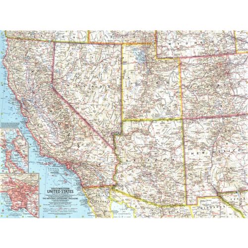
Southwestern United States Map - Published 1959
This map of the Southwestern United States features California, Nevada, Utah, Arizona, New Mexico, and Colorado. Includes detailed insets of the densely-populated San Francisco Bay and Los Angeles metropolitan areas. Published in November 1959, it is part of a series of six sectional maps of the United States published between 1958 and 1961.
Details
This map of the Southwestern United States features California, Nevada, Utah, Arizona, New Mexico, and Colorado. Includes detailed insets of the densely-populated San Francisco Bay and Los Angeles metropolitan areas. Published in November 1959, it is part of a series of six sectional maps of the United States published between 1958 and 1961.
More Information
| SKU | ngmaps-HM19591100-1 |
|---|---|
| Flat Size | 25 x 19 in |
| Publication Date | 1959 |
| Publisher Name | National Geographic |
Reviews
{{title}}
{{detail}}
No reviews yet ...
Have an opinion? Help others decide. Share your knowledge about this product by submitting a review.
{{/items}}
{{#previousPage}}
Previous Page
{{/previousPage}}
{{#load-more-src}}
Next Page
{{/load-more-src}}
★★★★★
★★★★★