Hawaii Map - Published 1960
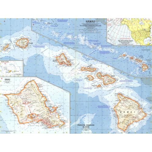
This map was created less than a year after Hawaii joined the United States as its 50th state. Features an overview map of the entire state as well as a detailed map of the principal islands. Ocean bathymetry, reefs and currents complete the picture of this exotic island region. Published in July 1960.
Details
This map was created less than a year after Hawaii joined the United States as its 50th state. Features an overview map of the entire state as well as a detailed map of the principal islands. Ocean bathymetry, reefs and currents complete the picture of this exotic island region. Published in July 1960.
More Information
| SKU | ngmaps-HM19600700-1 |
|---|---|
| Flat Size | 25 x 19 in |
| Publication Date | 1960 |
| Publisher Name | National Geographic |
Reviews
{{title}}
{{detail}}
No reviews yet ...
Have an opinion? Help others decide. Share your knowledge about this product by submitting a review.
{{/items}}
{{#previousPage}}
Previous Page
{{/previousPage}}
{{#load-more-src}}
Next Page
{{/load-more-src}}
★★★★★
★★★★★