Close-up USA, Wisconsin, Michigan, and the Great Lakes Map - Published 1973
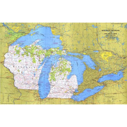
This map of the United States side of the western Great Lakes highlights the states of Wisconsin and Michigan. It details the vacation areas and sites throughout this beautiful region. Published in August 1973 as part of the "Close-up: U.S.A." series, with the travel poster "Wisconsin, Michigan, and the Great Lakes: Land Between the Waters."
Details
This map of the United States side of the western Great Lakes highlights the states of Wisconsin and Michigan. It details the vacation areas and sites throughout this beautiful region. Published in August 1973 as part of the "Close-up: U.S.A." series, with the travel poster "Wisconsin, Michigan, and the Great Lakes: Land Between the Waters."
More Information
| SKU | ngmaps-HM19730801-1 |
|---|---|
| Flat Size | 35.25 x 22.75 in |
| Publication Date | 1973 |
| Publisher Name | National Geographic |
Reviews
{{title}}
{{detail}}
No reviews yet ...
Have an opinion? Help others decide. Share your knowledge about this product by submitting a review.
{{/items}}
{{#previousPage}}
Previous Page
{{/previousPage}}
{{#load-more-src}}
Next Page
{{/load-more-src}}
★★★★★
★★★★★