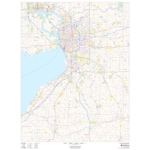
Erie County, New York Map
Map of Erie County, New York uses the base map data from TomTom. The data is updated every 6 months making this one of the most updated printed large map of Erie County, NY and its neighborhood areas.
This map is available in a scale of 1:70,000 in 36 x 48 inches in portrait orientation. If you want a map with different extents, or landscape orientation, or scale, you can do that by customizing the map here.
If you have any questions, we will be happy to answer over the phone (866) 525-2298 or write to us
Details
This map of Erie County, New York shows regional level information. Base map features include highways and major roads with labelling; neighborhood names; railways; high level land use such as parks and recreation areas, industrial areas and hospital campuses; and a selection of points of interest including transportation hubs like airports and train stations, tourist information, police stations and shopping centres. ZIP code boundaries are shown as a secondary map feature.
For Erie County Zip Code MapMore Information
| SKU | dmsg-county-str-erie-NY-1 |
|---|---|
| Map Scale | 1:70,000 |
| Flat Size | 36 x 48 in |
| Publication Date | 2019 |
| Publisher Name | MapSherpa |
Reviews
{{title}}
{{detail}}
No reviews yet ...
Have an opinion? Help others decide. Share your knowledge about this product by submitting a review.
{{/items}}
{{#previousPage}}
Previous Page
{{/previousPage}}
{{#load-more-src}}
Next Page
{{/load-more-src}}
★★★★★
★★★★★