Map of India and Pakistan
Details
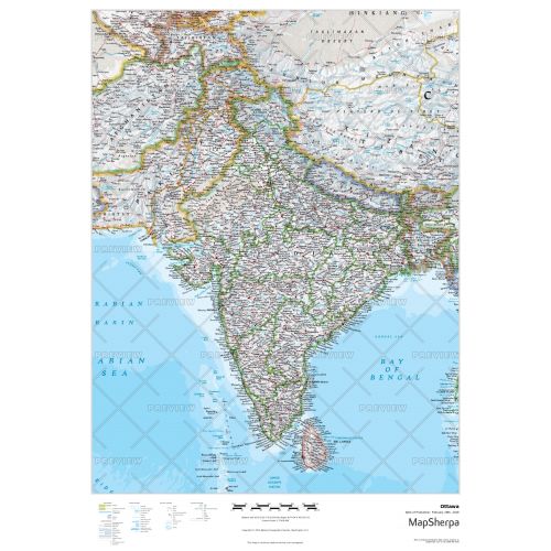
Map of India and Pakistan
This detailed map of India and Pakistan shows the major cities of both countries, provincial boundaries with neighboring countries and water bodies. It also features a map legend in the footer to explain the signs and symbols used throughout the map.
You can customize this map around your preferred location and your business service area by clicking on ‘Close Preview’. It comes with zoom buttons and drag and drop arrows to allow you to easily center the map around your desired area. After making all the adjustments you can give a personalized title that best suits your map. We also have a selection of sizes, orientations, and finishing materials for you to choose from.
Maps of Neighboring Countries
All the bordering countries and water bodies are visible on the map. However, you can also buy separate maps for these countries from the list below:
More Information
| SKU | e2aa4046f30305f8239c0cf8aad58833-ind_pak |
|---|---|
| Map Specification | Max Print Scale - 1:15,000 Min Print Scale - 1:2,000,000 Optimal Print Scale - All |
| Publisher Name | National Geographic |
Reviews
{{title}}
{{detail}}