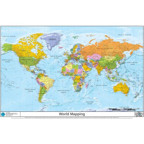
XYZ World Political
Very high resolution detailed World mapping with a combination of bright political colours and hill-shading. All the usual map features such as cities, roads, rivers, lakes, railways, airports and so forth. Updated in 2013, and winner of multiple awards. The Miller Cylindrical projection gives a good compromise between shape, scale and area.
Details
More about the custom world map with continents, countries, and capitals
This is a very high resolution detailed world map that combines bright colours, political features and hill-shading using terrain relief. Being a customizable map, it contains up-to-date information on map features such as cities, roads, rivers, lakes, airports & so forth. The map uses an optimum print scale of 1:20,000,000 and covers regions of Africa, Asia, Canada, North America and South America. Details on the map include individually highlighted countries of the world in distinct colours, clearly placed country names along with major cities, towns, oceans, mountains, islands, basins and more properly labelled for reference.
Buy Online at MapTrove online shop
The map can be used as an ideal reference tool as it is comprehensive and allows one to search for desired places, locate them, and centre them over the map easily. The final print of the map can be previewed before placing order and bought online with a customised title, orientation, size and material finish. You can order map with a title and finish of your choice.
Publisher: XYZ Maps
XYZ Maps offer a wide range of maps including postcode area maps, postcode district maps, postcode sector maps, custom made postcode maps, Europe Postcode maps, world maps, GIS/Map data, custom maps, map softwares, maps for business, study, giant maps, christmas gift maps, free maps and more.
More Information
| SKU | a3bab4272edbce4876df2eb237443f22 |
|---|---|
| Map Specification | Optimum Print Scale: 1:20,000,000 |
| Publisher Name | XYZ Maps |
Reviews
{{title}}
{{detail}}