South Korea
Details
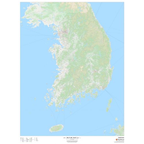
South Korea Map
This detailed map of South Korea features key cities and towns, road network and waterways with a backdrop of the geographic relief and land use of the country. A map legend featured in the footer denotes the signs and symbols used throughout the map. You can use it for references to the country and for business purposes. It is also ideal wall decor for offices and homes of people living in Korea and Korean expatriates.
Where is South Korea?
South Korea in East Asia constitutes the southern part of the Korean Peninsula and shares a land border with North Korea. The country extends 1,100 km (680 mi) from the Asian mainland and is flanked by the Yellow Sea to the west, and the Sea of Japan to the east. The southern tip of the country lies on the Korea Strait and the East China Sea.
Major Cities in South Korea
The country’s major administrative divisions comprise of eight provinces, one special self-governing province, six metropolitan cities, one special city, and one metropolitan autonomous city.
We have listed the names of 5 largest cities by population below. You can buy maps of these cities by clicking on their names.
More Information
| SKU | dmsg-oly-kr-s-korea-1 |
|---|---|
| Map Scale | 1:565,000 |
| Flat Size | 36 x 48 in |
| Publication Date | 2018 |
| Publisher Name | MapSherpa |
Reviews
{{title}}
{{detail}}