Islands of the Pacific - Atlas of the World, 10th Edition
Details
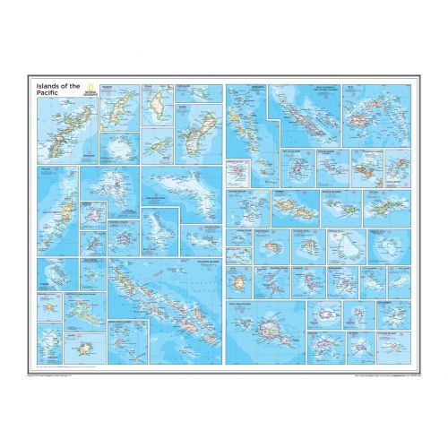
Pacific Islands Map
View fifty-four detailed inset maps of islands and island groups that correspond to numbered locations on the preceding overview Pacific Islands map (Pacific Ocean Political, plate 109). Every inset map highlights the political and physical feature of the island. It uses relief shading and different color hues to depict terrains, vegetation, and the height above sea level.
This high-quality and comprehensive map is ideal for referential purpose in homes and offices. You can purchase it in a selection of finishes like paper, matte plastic, and laminated.
Pacific Islands
The Pacific Islands are a group of islands in the Pacific Ocean. Its three major groups are Polynesia, Micronesia, and Melanesia. These islands, depending on the context, refers to both countries and islands with common Austronesian origins.
Below is a list of 5 largest Pacific islands by area:
- New Guinea
- Honshu
- Sulawesi
- South Island
- North Island
More Information
| SKU | ngmaps-POD10th110-1 |
|---|---|
| Flat Size | 28 x 22 in |
| Publication Date | 25-02-2015 |
| Publisher Name | National Geographic |
Reviews
{{title}}
{{detail}}