World Physical
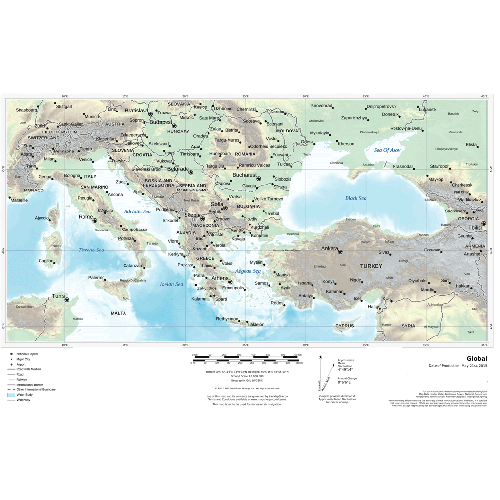
This physical map displays relief features on the earth by colouring the land elevations and water depths. International boundaries, major towns and cities are displayed with the country capitals clearly marked. Major airports, roads and railway networks are represented, depending on the scale of your map. These wall maps are suitable for home, office or the classroom. Custom maps can have a scale from approximately 1:500,000 to 1:40,000,000.
Details
This physical map displays relief features on the earth by colouring the land elevations and water depths. International boundaries, major towns and cities are displayed with the country capitals clearly marked. Major airports, roads and railway networks are represented, depending on the scale of your map. These wall maps are suitable for home, office or the classroom. Custom maps can have a scale from approximately 1:500,000 to 1:40,000,000.
More Information
| SKU | e669f28bb6353eb56890114917f4d46b |
|---|---|
| Map Specification | Max Print Scale - 1:500,000 Min Print Scale - 1:15,000,000 Optimal Print Scale - All |
| Publisher Name | MapSherpa |
Reviews
{{title}}
{{detail}}