Mali
Details
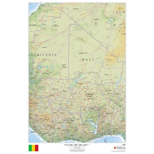
Mali Map
Explore the diverse and iconic landscapes of the African countries in this detailed Mali map. This map is designed to show both physical and political features of Mali and its surrounding areas. It uses relief shading and the different colors to depict the height above sea level.
You can easily find locations of cities and towns with states borders, provincial boundaries, and the national capital, Bamako. A small image of the national flag is also featured on the bottom of the map. This vertical tricolor flag features green, gold and red colors with a human stick figure (Kanaga) in black centered in the gold band.
Where is Mali?
The landlocked country of Mali in West Africa lies between latitudes 10° and 25°N, and longitudes 13°W and 5°E. Most of the country is flat and rises to the rolling northern plains covered by sand. It lies mostly in the Southern Sahara Desert.
Major Cities in Mali
Mali's population was estimated at 18 million in 2016. It was predominantly rural and of Malians nomadic. And more than 90% of this population lives in the southern part of the country.
Below is a list of the 5 largest cities in the country by population. You can buy maps of all these cities by clicking on their respective names. Also, all these city maps are customizable, i.e you can center them around your preferred location and order them in various sizes and finishes.
Mali’s Neighboring Places
Mali shares its border with a number of countries. You can find maps of all these countries separately by clicking on their name below:
More Information
| SKU | dmsg-rel-mail-1 |
|---|---|
| Map Scale | 1:3,300,000 |
| Flat Size | 24 x 36 in |
| Publication Date | 2018 |
| Publisher Name | MapSherpa |
Reviews
{{title}}
{{detail}}