Fremont Map
Details
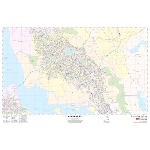
This map of Glenwood Springs has been designed with accuracy based on well-researched data. Significant physical attributes like, Major Rivers, lakes, recreation parks(Fremont Central Park), are clearly visible on the map. The map highlights Municipal, town, and Zip code boundaries.
Transportation routes ( I-880, I-680, SR-238, SR-84) interlinking the cities of California, the USA is marked neatly in the map with color-coded markings.. Major infrastructure like colleges, airports, police stations, shopping malls, industrial complexes, hospitals train stations is also identifiable.
About Fremont, California
Fremont is a city in Alameda County, California, United States. Located in the South of the East Bay region of the San Francisco Bay Area. Fremont is the closest East Bay City to Silicon Valley as formally defined, and is often associated with it. The City has an extensive and rapidly expanding base of both the tech industry and workers.
The area consisting of Fremont and the Cities of Newark and Union City is collectively known as the Tri-City Area. The Zip code of the Fremont City Range from 94536-94539,94555. The area codes of the City are 510,341.
Cities and Towns Bordering Irvine, California
- North-Tustin
- Northwest- Santa Ana
- East-Lake Forest
- Southeast-Laguna Hills and Laguna woods
- Southwest-Newport Beach
- West- Costa Mesa
More maps of California Cities
More Information
| SKU | svd_ca_fremont_24 |
|---|---|
| Map Scale | 1:24,000 |
| Flat Size | 24 x 36 in |
Reviews
{{title}}
{{detail}}