Orange Map
Details
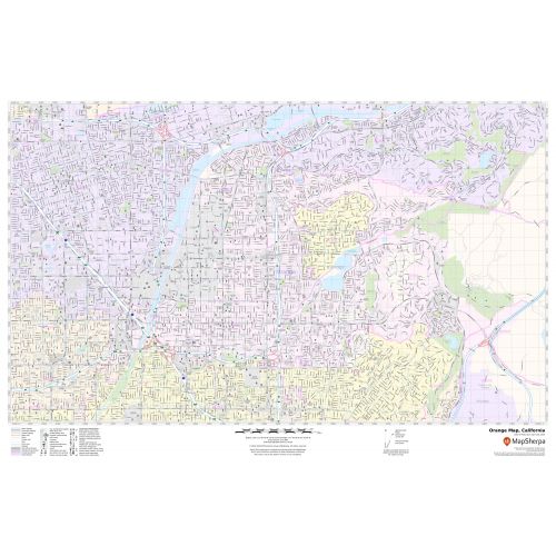
In this highly detailed Orange City Map, you can find various points of interest and land use areas marked in the city. The map highlights Municipal, town, and ZIP code boundaries. The map also shows the latest changes in your area. The map includes extensive Geographic details like River, lakes, interstate (I-5) (SR-22), and state highways (SR-57), streets with street names, at detailed scales.
The map also depicts a high-level land use like parks, museums, recreation areas, industrial areas, and hospital campuses. Major infrastructure like airports, police stations, shopping malls, industrial complexes, train stations is also identifiable.
About Orange, California
Orange is a city located in Orange County, California. It is approximately 3 miles (4.8 kilometers) north of the Country seat, Santa Ana. Orange City is home to parks, lakes, a small Zoo, a university, and a wildlife Sanctuary. The outlets at Orange, a large, outdoor shopping and entertainment center, is located at the southwestern edge of the City.Old Town, Orange Historic District was listed on the National Register of Historic Places in 1997.
Facts and Figures of Orange, California
- Latitudinal and longitudinal Coordinates-33.48’11” N 117.49’57” W
- Elevation - 190 Ft (58 m)
- Zip Code - 92856-92869
- Area Code - 657/714
- Total Area - 25.80 sq miles(66.81km2)
More maps of California Cities
More Information
| SKU | svd_ca_orange_24 |
|---|---|
| Map Scale | 1:15,000 |
| Flat Size | 24 x 36 in |
Reviews
{{title}}
{{detail}}