Thornton Map
Details
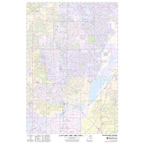
Details on the map
The map includes extensive Geographic details. Railways, ferry routes, and high-level land use such as parks and recreation areas; industrial areas; postal districts and hospital campuses are mentioned at a detailed scale. The base map features all the major roads and highways(I-25, I-76, I-270) including secondary and Tertiary highways labeled with neighborhood names.
A map legend featured at the bottom helps identify all signs and symbols used on the map. The scale of the map is 1:19,000. The max print scale of the map is 1:10,000 and the Min Print scale is 1:2,000,000. The customizable map is available in landscape and portrait orientation and various sizes. This high-quality Thornton, Colorado map is available in various premium finishes including paper, canvas, and laminated.
Uses of the Map
This map serves various travel, business, and organizational functions including service delivery, real estate, sales territories, region planning and much more. The elaborate road networks make this map an ideal tool for general reference and planning long-distance trips. The map's descriptive nature is clear and graspable which makes it apt for business and reference use.
Major Cities near Thornton, Colorado
- 3 miles to Welby
- 8 miles to Commerce City
- 9 miles to Denver, Colorado
- 12 miles to Aurora, Colorado
- 72 miles to Colorado Springs, Colorado
- 342 miles to Albuquerque, New Mexico
- 432 miles to Wichita, Kansas
Information of Thornton, Colorado
Thornton is a home rule municipality in Adams and Weld Counties in the U.S state of Colorado, located in the northeast quadrant of the Denver-Aurora-Brookfield, Colorado metropolitan area. Thornton is 10 miles(16 km) north/northeast of downtown Denver. Thornton is the sixth-most populous city in the state of Colorado.
Thornton is located at 39.54’11” N104.57’16” W. The City. The city has a total area of 36.1square miles(93 km2), of which 35.1 square miles(91km2) is land and 1square miles (2 km2) is water.
Recreation in Thornton, Colorado
Thornton has 81 City parks and nearly 2,000 acres (8.1km2) of parks and open space. There are over 80 miles(130 km) of trails throughout the City. Recreational facilities include the Margaret Carpenter Recreation Center and Thornton Community Center. Golf Courses include the Thorncreek Golf Course and Todd Creek Golf.
ZIP Codes of Thornton, Colorado
The area code of Thornton 303 and 720. Thornton Colorado has 4 ZIP codes roughly and is 80241, 80233,80299,80260.
Neighborhood in or near Thornton, Colorado
Some of the popular neighborhoods near Thornton city, Colorado are:
- Gleneagle Estates
- Lake every Estate
- Riverside peaks
- Hawk Ridge
- Heritage Todd Creek
- King Ranch Estates
- North Creek Farms
- Rolling Hills
- Briar Ridge
- Downing Park
More Information
| SKU | svd_co_thornton_24 |
|---|---|
| Map Scale | 1:19k |
| Flat Size | 24 x 36 in |
Reviews
{{title}}
{{detail}}