Tampa FL, Map
Details
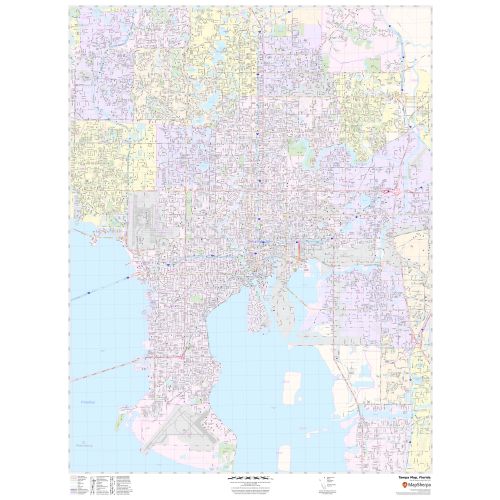
This map of Tampa City has been created based on well-researched data with accuracy. The map has a detailed outline of Municipal, town, and ZIP code boundaries. Transportation routes(I-275, I-75, I-4, US-92, SR-60, SR 618, SR-589) interlinking Cities of Florida, USA are marked neatly in the map with color-coded markings.
Details on The Map
The map explains high-level land use like parks, recreation areas, industrial areas, and hospital campuses. Major infrastructure like airports, police stations, shopping malls, industrial complexes, train stations is also identifiable. Railways, ferry routes, landmarks, and a variety of major points of interest are included in this map. The product has been designed to make custom maps suitable from City to County Scales, and anywhere in between.
The customizable map is available in portrait and landscape orientation. The title of your choice can also be added to the map. A map legend at the bottom helps identify all signs, symbols, and graphics used on the map.
Uses of Map
Apart from your specific requirements, you can also use this map for various business functions including planning delivery, sales region planning, retail sitting, and real estate. You can add this map to your office wall decor. This map makes an attractive wall display in offices, educational institutions, business centers, and home study. The elaborate road networks make this map by Mapsherpa an ideal tool for general reference and planning long-distance trips.
Information about, Tampa Florida
Tampa is a major city in and the county seat of, Hillsborough County, Florida, U.S.A. It is on the west coast of Florida on Tampa Bay, near the Gulf of Mexico. Today, Tampa is part of the metropolitan area most commonly referred to as the ”Tampa Bay Area”.Tampa is the largest city in the Tampa Bay Area. The bay’s port is the largest in the state, near downtown’s Channel District. Finance, retail, healthcare, insurance, shipping, by air and sea, national defense, professional sports, tourism and real estate all play vital roles in the area’s economy.
Geography of Tampa, Florida
Tampa is bordered by two bodies of water, Old Tampa Bay and Hillsborough Bay, which in turn flows into the Gulf of Mexico. The Hillsborough River flows into Hillsborough Bay, passing directly in front of Downtown Tampa and supplying Tampa’s main source of fresh water. Tampa’s geography is marked by the Interbay Peninsula which divides Hillsborough Bay(the eastern) from Old Tampa Bay(the western).
Neighborhoods and ZIP codes in Tampa, Florida
Tampa City is divided into many neighborhoods, many of which were towns and Unincorporated communities annexed by the growing city. Well, known neighborhoods include Ybor City, Forest Hills, Ballast Point, Sulphur Springs, Seminole Heights, Tampa Heights, College Hill, and non-residential areas of Gary and Westshore Business District.
In total, Tampa, Florida covers 58 Zip codes roughly. These Zip codes range from 33544, 33602-33694. Generally, the city is divided into the following broad areas of neighborhoods with Zip codes.
| Zip codes | Regions |
| 3602, 33606 | Downtown |
| 33604 and 33612 | North Tampa |
| 33608-33609,33611,33616,33621,33629 | South Tampa |
| 33605 and 33610 | East Tampa |
| 33544, 33646 and 33647 | New Tampa |
More Maps Of Florida
More Information
| SKU | svd_fl_tampa_36 |
|---|---|
| Map Scale | 1:29k |
| Flat Size | 36 x 48 in |
Reviews
{{title}}
{{detail}}