Map of Chicago, Illinois
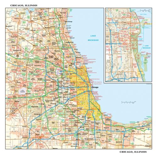
This detailed reference map combines two maps in one - a regional map of the Chicagoland area plus a street-level map of downtown Chicago. The regional map shows the area's cities and towns, highways and roads, and a variety of points of interest. Joliet, Aurora, Elgin, and Highland Park are among the suburbs near Chicago that are featured on this map. The highly detailed inset of the Chicago central business district shows highways, streets, parks, landmarks, and other points of interest. The Loop, Printer's Row, Chinatown, and the Near North are among the neighborhoods shown on this map.
Details
This detailed reference map combines two maps in one - a regional map of the Chicagoland area plus a street-level map of downtown Chicago. The regional map shows the area's cities and towns, highways and roads, and a variety of points of interest. Joliet, Aurora, Elgin, and Highland Park are among the suburbs near Chicago that are featured on this map. The highly detailed inset of the Chicago central business district shows highways, streets, parks, landmarks, and other points of interest. The Loop, Printer's Row, Chinatown, and the Near North are among the neighborhoods shown on this map.
More Information
| SKU | globeturner-GT015-CIT-CHI-16-1 |
|---|---|
| Flat Size | 15 x 14.5 in |
| Publication Date | 2016 |
| Publisher Name | Globe Turner |
Reviews
{{title}}
{{detail}}
No reviews yet ...
Have an opinion? Help others decide. Share your knowledge about this product by submitting a review.
{{/items}}
{{#previousPage}}
Previous Page
{{/previousPage}}
{{#load-more-src}}
Next Page
{{/load-more-src}}
★★★★★
★★★★★
Related Products
Map of Illinois
As low as
$26.99
Cook County Map (Illinois)
As low as
$39.99
Rockford ZIP Code Map, Illinois
As low as
$41.99
Chicago IL Zip Code Map
As low as
$39.99
Cook County ZIP Code Map (Illinois)
As low as
$39.99
Central Chicago Map, Illinois - Landscape
As low as
$39.99
Central Chicago Map, Illinois - Portrait
As low as
$39.99