Lewisville Map
Details
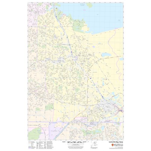
This map of Lewisville has been designed with accuracy based on well-researched data. Significant physical attributes like lakes (Lewisville Lake),(Lake Dallas), recreation parks, are clearly visible on the map. The map highlights Municipal, town, and Zip code boundaries.
Transportation routes (I-35E, U.S-77, SH-121) interlinking the cities of Texas, the USA is marked neatly in the map with color-coded markings. Major infrastructure like colleges, airports, police stations, shopping malls, industrial complexes, hospitals train stations is also identifiable.
About Lewisville, Texas
Louisville is a city located in the southern end of Denton County, Texas, United States. It is a suburb within the Dallas-Fort Worth Metroplex. It occupies 36.4 square miles(94 km2) of land and includes 6.07 square miles (15.7 km2) of Lewisville Lake. The city’s proximity to Lewisville Lake has made it a recreational hub of the Dallas-Fort Worth Metroplex. The diversity of its population and industry has created a stable economic climate in the City.
The Zip codes of the city are 75029,75057,75067,75077 and the area code is 214, 469, and 972.
More maps of Texas Cities
More Information
| SKU | svd_tx_lewisville_24 |
|---|---|
| Map Scale | 1:16,000 |
| Flat Size | 24 x 36 in |
Reviews
{{title}}
{{detail}}