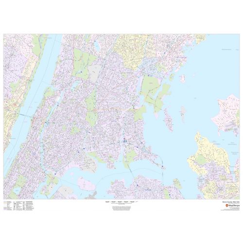
Bronx County, New York Map
Bronx County map, New York shows regional and street-level information. The base map includes highways, major roads, neighborhood names, railways, high-level land use like parks, recreation areas, industrial areas, and hospital campuses. Major infrastructures like airports and train stations, tourist information, police stations, and shopping centers are also identifiable. The ZIP code boundaries are shown as a secondary map feature.
Details
This map of Bronx County, New York shows detailed street level information including extensive street labeling. Ideal for planning of deliveries, home services, sales territories, real estate and much more. Base map features include all roads with major roads and highways labelled; neighborhood names; railways; high level land use such as parks and recreation areas, industrial areas and hospital campuses; and a variety of points of interest including schools, libraries, stadiums, museums, border crossings and more. ZIP code boundaries are shown as a secondary map feature. For Bronx Map
More Information
| SKU | dmsg-county-str-bronx-NY-1 |
|---|---|
| Map Scale | 1:20,000 |
| Flat Size | 48 x 36 in |
| Publication Date | 2019 |
| Publisher Name | MapSherpa |
Reviews
{{title}}
{{detail}}
No reviews yet ...
Have an opinion? Help others decide. Share your knowledge about this product by submitting a review.
{{/items}}
{{#previousPage}}
Previous Page
{{/previousPage}}
{{#load-more-src}}
Next Page
{{/load-more-src}}
★★★★★
★★★★★