Pompano Beach FL, Map
In this highly detailed Pompano Beach City Map, one can find various points of interest and land use areas marked in the city. The map also shows the latest changes in your area. The map includes additional geographic details like beaches, highways (SR-A1A), streets with street names, at detailed scales. The map also shows land use like parks, recreation areas, industrial areas, and hospital campuses. Major infrastructure like airports, police stations, shopping malls, industrial complexes, train stations is also identifiable.
About Pompano Beach, Florida
Pompano Beach is a city in northeastern Broward County, Florida, United States, along the coast of the Atlantic Ocean, just to the north of Fort Lauderdale. The nearby Hillsboro Inlet forms part of the Atlantic Intracoastal Waterway. Located 35 miles north of Miami, it is a principal city of the Miami metropolitan area. The City has also been listed as one of the top real estate markets. Pompano Beach Airpark, located within the City, is home to the Goodyear Blimp Spirit of Innovation.
Bordering Pompano Beach, Florida
- Northeast-Hillsboro Beach, Lighthouse Point
- South- Fort Lauderdale
- Southwest-Margate, North Lauderdale
- North- Deerfield Beach
- SouthEast-Lauderdale-by-the Sea
- West-Coconut Creek
More Maps Of Florida Cities
| SKU | svd_fl_pompano_beach_24 |
|---|---|
| Map Scale | 1:14k |
| Flat Size | 24 x 36 in |


-
![Pompano Beach ZIP Code Map, Florida]() Pompano Beach ZIP Code Map, FloridaPrice from $41.99
Pompano Beach ZIP Code Map, FloridaPrice from $41.99 -
![Coconut Creek ZIP Code Map, Florida]() Coconut Creek ZIP Code Map, FloridaPrice from $41.99
Coconut Creek ZIP Code Map, FloridaPrice from $41.99 -
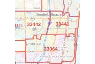
![Deerfield Beach ZIP Code Map, Florida]() Deerfield Beach ZIP Code Map, FloridaPrice from $41.99
Deerfield Beach ZIP Code Map, FloridaPrice from $41.99 -
![Lighthouse Point ZIP Code Map, Florida]() Lighthouse Point ZIP Code Map, FloridaPrice from $41.99
Lighthouse Point ZIP Code Map, FloridaPrice from $41.99 -
![Deerfield Beach FL, Map]() Deerfield Beach FL, MapPrice from $24.99
Deerfield Beach FL, MapPrice from $24.99 -
![Coconut Creek FL, Map]() Coconut Creek FL, MapPrice from $24.99
Coconut Creek FL, MapPrice from $24.99