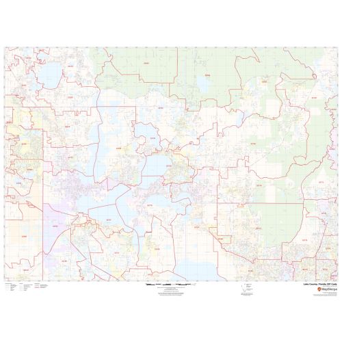
Lake County ZIP Code Map, Florida
This Zip Code Map of Lake County, Florida has been sketched based on well-researched accurate data showing various Zip Codes in the area. It marks all 5 digit Zip code areas using red boundaries overlaid on the road map. Significant physical attributes like, Forest Areas, Major water bodies, recreation parks are visible on the map. Transportation routes (U.S-27, U.S-441 and more) interlinking the state of Florida, USA are marked on the map. Major infrastructure like colleges, airports, Police stations, industrial complexes, hospitals are also identifiable.
Details
About Lake County, Florida
Lake County is a county in the central portion of the U.S state of Florida. The county seat is Tavars, and the largest city is Clermont. Lake County is included in the Orlando-Kissimmee-Sanford, Florida Metropolitan Statistical Area. Lake County, Florida covers 15 Zip Codes roughly which range between 95422-95493 and area code is 707.
Adjacent Counties surrounding Lake County, Florida
- South- Polk County
- Southeast- Osceola County
- North- Boulder County,
- East- Orange County, Seminole County
- Northeast - Volusia County
- West- Sumter County
- Northwest- Marion County
More Information
| SKU | svd_lake_county_fl |
|---|---|
| Map Scale | 1:42,000 |
| Flat Size | 36 x 48 in |
Reviews
{{title}}
{{detail}}