Jackson County Zip Code Map, Missouri
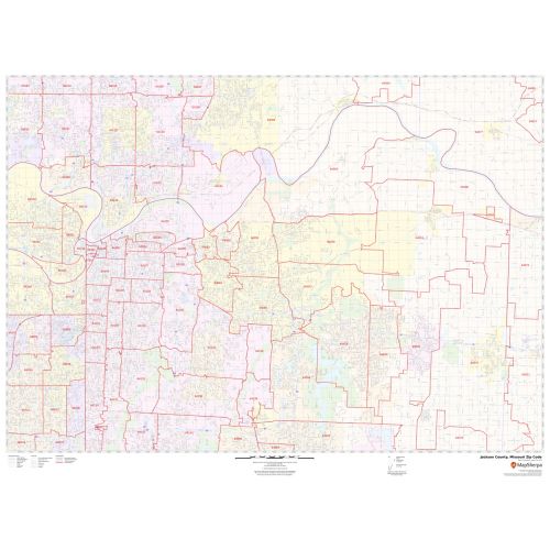
This is a detailed Jackson County Zip Code Map, Missouri showing various Zip Codes in the area. It marks all 5 digit Zip code areas using red boundaries overlaid on the road map. City, township, and municipality areas are also demarcated with distinct colors.
This map is available in a scale of 1:35,000 in 48 x 36 inches in landscape orientation. If you want a map with different extents, or portrait orientation, or scale, you can do that by customizing the map here. If you have any questions, we will be happy to answer over the phone (866) 525-2298 or write to us
Details
Details on the Jackson County Zip Code Map, Missouri
The base map features all the major roads and highways (I-29, I-35, I-49, U.S-24, U.S-40, Route-7, and more) along with neighborhood names. Significant physical attributes like, Forest Areas, Major water bodies (Missouri River, Longview Lake, and more) are visible on the map. Airport, Railways, ferry routes, and high-level land use like parks and recreation areas, industrial areas, museums( American Jazz Museum and more) postal districts, and hospital campuses, are mentioned at a detailed scale. A map legend featured at the bottom helps identify all signs and symbols used on the map. There is also the option of adding the title of one’s own choice to the Map.
Uses of Jackson County, Missouri Zip Code Map
This map can be used in multiple ways for various business functions including planning delivery, retail sitting, sales region planning, and real estate. This map is also used for direct mail marketing via some companies. The elaborate road networks make this map an ideal tool for general references and planning long-distance trips.
This map can be used in multiple ways for various business functions including planning delivery, retail sitting, sales region planning, and real estate. This map is also used for direct mail marketing via some companies. The elaborate road networks make this map an ideal tool for general references and planning long-distance trips.
Customization options available for Jackson County, Missouri Zip Code Map
We have a high-quality, customizable version of this map that can be centered around any area of your choice. The zoom buttons and drag arrows on the map will help you define the print area. Logistic and service delivery businesses can also use these maps for cropping their service delivery area maps from the base maps. Holiday home/cottage owners can create customized maps with the location of their holiday home and crop the area to order a customized map poster for their wall. The map can be customized in both portrait and landscape orientation.
Facts and Figures of Jackson County, Missouri
- Latitudinal and longitudinal Coordinates- 39.01’N 94.20’W
- Total Area- 616 sq miles (1,600 km2)
- Total Land Area-604 sq miles (1,560 km2)
- Total Water Area-12 sq miles (30 km2)
About Jackson County, Missouri
Jackson County is located in the western portion of the U.S.of Missouri. Jackson County is the most populated county and is the most populated county in the Kansas City metropolitan area.
Adjacent counties near Jackson County, Missouri
- West- Johnson County, Kansas
- Southeast- Johnson County
- South- Cass County, Missouri
- North- Clay County, Missouri
- Northeast- Ray County
Zip Codes of Jackson County, Missouri
Jackson County, Missouri roughly covers 74 Zip Codes. These range between 64002-64088, 64101-64199, 64999. USPS introduced these codes in the country in 1963 with an aim of an effective mail delivery system. Apart from mail delivery, these codes are used for monitoring statistics, direct mail marketing, Internet routing, and credit card security. The area code of the county is 816 and Jackson County, Missouri covers 12 Cities.
National Protected Area and points of Interest in Jackson County, Missouri
- Harry S Truman National Historic Site
- Kansas City Public Library
- Linda Hall Library
- Mid-Continent Public Library
- National World War I Museum and Memorial
- Fort Osage National Historic Landmark
- Missouri Town 1855
- Vaile Mansion
- Kansas City Museum
More Information
| SKU | svd_jackson_county_mo |
|---|---|
| Map Scale | 1:35K |
| Flat Size | 36 x 48 in |
Reviews
{{title}}
{{detail}}