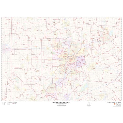
Montgomery County Zip Code Map, Ohio
The self-explanatory Montgomery County Zip Code Map, Ohio depicts Zip codes that are written in a 5-digit format. These digits are divided into 3 main parts- the national area, the region or city, and the delivery area. The base map also features detailed information about forested areas (Dayton Aviation Heritage National Historical Park), water bodies, major highways (I-70, I-75, US-25, SR-4) neighborhoods, borders, and other major landmarks. The map also depicts Airport’s hospital campuses, postal districts, industrial areas, and recreation areas and parks, and much more. A map legend featured at the bottom helps all the signs, characters graphics, and symbols used throughout the map.
This map is available in a scale of 1:70,000 in 48 x 36 inches in landscape orientation. If you want a map with different extents, or portrait orientation, or scale, you can do that by customizing the map here. If you have any questions, we will be happy to answer over the phone (866) 525-2298 or write to us
Details
About Montgomery County, Ohio
Montgomery County is located in the southwestern portion of the U.S state of Ohio. The county seat is Dayton. Montgomery County is part of the Dayton, Ohio Metropolitan Statistical Area.
Bordering Montgomery County, Ohio
- East- Greene County
- North- Miami County
- South- Warren County
- West- Preble County
- Southwest- Butler County
- Northwest- Darke County
More Information
| SKU | svd_montgomery_county_oh |
|---|---|
| Map Scale | 1:70K |
| Flat Size | 36 x 48 in |
Reviews
{{title}}
{{detail}}