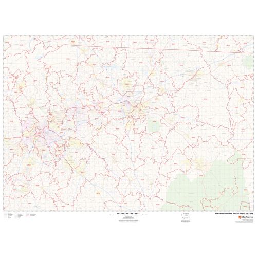
Spartanburg County Zip Code Map, South Carolina
An ideal Spartanburg County Zip Code Map, South Carolina displays all the Zip Codes within the County marked with red boundaries. The map also depicts major roads (I-26, I-85, I-585, and more), street details, and more. Significant physical attributes like forested areas, water bodies, recreation parks (Cleveland Park, North Spartanburg Park, and more) are visible on the map. Major infrastructure like College and University (University of South Carolina Upstate), post offices, airports, police stations, industrial complexes are also identifiable. A map legend featured at the bottom helps all the signs, characters, graphics, and symbols used throughout the map for a better explanation.
This map is available in a scale of 1:70,000 in 48 x 36 inches in landscape orientation. If you want a map with different extents, or portrait orientation, or scale, you can do that by customizing the map here. If you have any questions, we will be happy to answer over the phone (866) 525-2298 or write to us
Details
About Spartanburg County, South Carolina
Spartanburg County is a County located on the northwestern border of the U.S state of South Carolina. Its county seat is Spartanburg. Spartanburg County is coterminous with the Spartanburg, SC Metropolitan Statistical Area, which is also included in the Greenville-Spartanburg-Anderson, SSC Combined Statistical Area.
Spartanburg County, South Carolina covers 38 Zip Codes roughly which range from 29301-29388 and the area code is 864.
More Information
| SKU | svd_spartanburg_county_sc |
|---|---|
| Map Scale | 1:70K |
| Flat Size | 36 x 48 in |
Reviews
{{title}}
{{detail}}