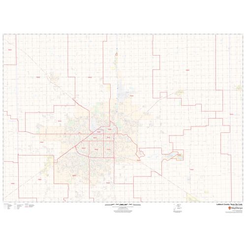
Lubbock County Zip Code Map, Texas
The detailed Lubbock County Zip Code Map, Texas explains various zip codes in the area. It marks all 5 digit zip code areas using red boundaries overlaid on the road map as well as the physical features. The major roads and highways ( I-27, US-62, US-84, U.S-87, State Highway -114, Loop-289) and recreational areas, parks (Maxey Park, Clapp park, and more) are easily identifiable on the map. Airports, Railways, ferry routes and industrial areas, postal districts, and hospital campuses are mentioned at a detailed scale. A map legend at the bottom helps identify all signs and symbols used on the map.
This map is available in a scale of 1:35,000 in 48 x 36 inches in landscape orientation. If you want a map with different extents, or portrait orientation, or scale, you can do that by customizing the map here. If you have any questions, we will be happy to answer over the phone (866) 525-2298 or write to us
Details
About Lubbock County, Texas
Lubbock County is a county in the U.S. state of Texas. Its county seat is Lubbock. Lubbock County, along with Crosby County, and Lynn County, is part of the Lubbock Metropolitan Statistical Area (MSA). Lubbock MSA and Levelland Micropolitan Statistical Area encompassing only Hockley County, form the larger Lubbock-Levelland Combined Statistical Area. Lubbock County, Texas Covers 32 ZIP Codes roughly ranging from 79329-79382, 79401-79499 and the area code is 806.
More Information
| SKU | svd_lubbock_county_tx |
|---|---|
| Map Scale | 1:35k |
| Flat Size | 36 x 48 in |
Reviews
{{title}}
{{detail}}