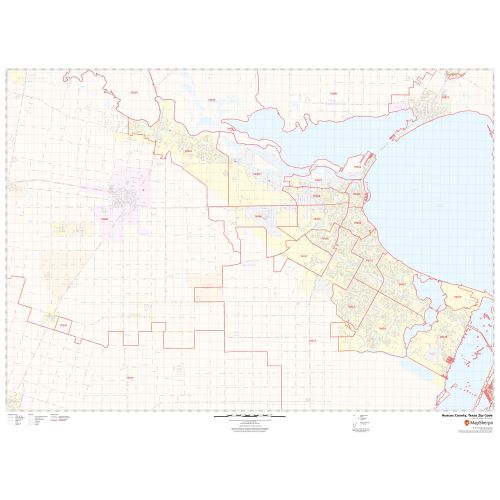
Nueces County Zip Code Map, Texas
This Zip Code Map of Nueces County, Texas has been sketched based on well-researched accurate data showing various Zip Codes in the area. It marks all 5 digit Zip Code areas using red boundaries overlaid on the road map. Significant physical attributes like, Forest Areas, Major water bodies (Nueces River, and more) recreation parks are visible on the map. Transportation routes (I-37, I-69, U.S-77, U.S-181, SH-77, and more) interlinking the state of Texas, USA are marked on the map. Major infrastructure like colleges, airports, Police stations, industrial complexes, hospitals is also identifiable.
This map is available in a scale of 1:35,000 in 48 x 36 inches in landscape orientation. If you want a map with different extents, or portrait orientation, or scale, you can do that by customizing the map here. If you have any questions, we will be happy to answer over the phone (866) 525-2298 or write to us
Details
About Nueces County, Texas
Nueces County is a county located in the U.S. state of Texas. Its County Seat is Corpus Christi. The County is named after the Nueces River, which marks the county's northwestern boundary with San Patricio County before emptying into its mouth at Nueces Bay north of the port of Corpus Christi. Nueces County is part of the Corpus Christi Metropolitan Statistical area. It borders the Gulf of Mexico.
More Information
| SKU | svd_nueces_county_tx |
|---|---|
| Map Scale | 1:35k |
| Flat Size | 36 x 48 in |
Reviews
{{title}}
{{detail}}