Milwaukee Zip Code Map
This map is available in a scale of 1:30,000 in 36 x 48 inches in portrait orientation. If you want a map with different extents, or landscape orientation, or scale, you can do that by customizing the map here. If you have any questions, we will be happy to answer over the phone (866) 525-2298 or write to us
Details
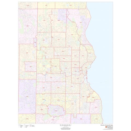
Milwaukee WI Zip Code Map
Our high-quality Milwaukee Zip Code map marks clear Zip code boundaries with extensive geographic details. It features accurate information about all major roads and highways, neighborhood names, railways, and high-level land use such as parks and recreation areas, industrial areas and hospitals. A map legend at the bottom helps to identify signs and symbols used throughout the map. You can shop for this detailed map in a variety of finishing materials like paper, matte plastic, and lamination.
How to use this map?
Apart from your specific requirements, there are multiple ways in which you can use this map:
- It is ideal for business functions that involve tracking down delivery service areas, sales territories, and catchment areas.
- You can also plan direct mail marketing services using this map.
- Or simply use this as wall decor in your home or office.
How to customize this Milwaukee Zip Code map?
You can use the customizable version of this map to get a more accurate print of your business service area, sales territory, or your neighborhood in the city. This map includes a zoom-in feature that allows you to get a closer look at the streets and roads of the city. You can center the map on your location, crop the area of your interest, select the orientation of your choice and choose from 5 different paper sizes and 4 types of paper finishes.
Start editing this custom map of Milwaukee here.
More maps of Milwaukee
- Milwaukee County Map - County map featuring detailed road information, available in 36 x 48 inches.
- Milwaukee County ZIP code Map - Zip Code map of the entire county, available in portrait orientation in 36 x 48 inches.
- Milwaukee, Wisconsin Inner Metro - Portrait Map - City's Inner metro map, available in 36 x 48 inches.
- Milwaukee, Wisconsin Inner Metro - Landscape Map - City's Inner metro map, available in 48 x 36 inches.
More Information About Milwaukee
The city of Milwaukee is the fifth-largest city in the Midwestern United States. It is situated on Lake Michigan's western shore and has an estimated population of 594,511. This city is also the main cultural and economic center of the Milwaukee metropolitan area which has a population of 2,043,904.
Milwaukee is located along the shores and bluffs of Lake Michigan at the confluence of three rivers namely the Menomonee, the Kinnickinnic, and the Milwaukee. Many small rivers like the Root River and Lincoln Creek also flow through the city.
What are the Zip Codes in Milwaukee?
There are more than 20 Zip Codes in the city, all of which have a prefix of 532xx. These are maintained for mail delivery purposes and are essential for planning deliveries. Other than that, these are also used for monitoring statistics, direct mail marketing, internet routing, and credit card security.
Neighborhoods in Milwaukee
- Milwaukee's North Side - This region includes famous neighborhoods like Arlington Heights, Brewers' Hill, Franklin Heights, Granville, Grover Heights, Halyard Park, Harambee, Havenwoods, Hillside / Lapham Park, Metcalfe Park, Midtown, Park West, Sherman Park, Thurston Woods, and Williamsburg Heights.
- Milwaukee's South Side - It comprises of Bay View, Clarke Square, Holler Park, Jackson Park, Jones Island, Layton Park, Lincoln Village, Mitchell Street, Tippecanoe, Town of Lake, and Walker's Point.
- Milwaukee's East Side - The region mainly comprises of "The East Side" which includes Lower East Side, East Village and Murray Hill, and Riverwest that includes Beerline B.
- Milwaukee's West Side - It consists of the Avenues West, Cold Spring Park, Historic Concordia District, Enderis Park, Kops Park, Grantosa Heights, Martin Drive, Merrill Park, Mount Mary, Story Hill, Walnut Hill, Washington Heights and Washington Park.
- Milwaukee's Downtown - It comprises of the East Town, Menomonee River Valley, Historic Third Ward, and Westown.
More Information
| SKU | dmsg-zip-milwaukee-1 |
|---|---|
| Map Scale | 1:30,000 |
| Flat Size | 36 x 48 in |
| Publication Date | 2019 |
| Publisher Name | MapSherpa |
Reviews
{{title}}
{{detail}}