Mauritania
Details
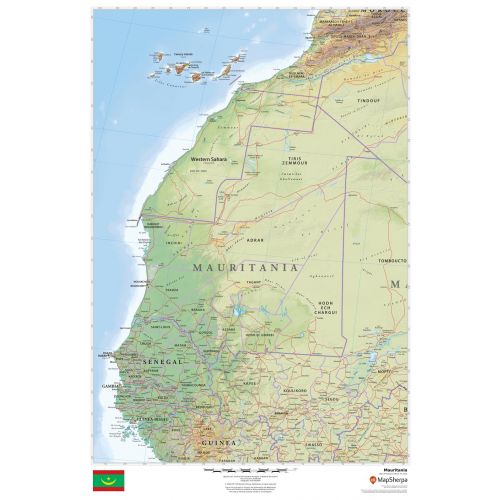
Mauritania Country Map
This detailed Mauritania map includes land information about the country’s political and physical features. Relief shading and different color hues used throughout the map depicts the height above sea level. You can view all major cities including the capital city, Nouakchott, and other surrounding places on the map. A small flag of the country is also featured at the bottom of the map. This national flag has 2 red stripes on the top and bottom and a green field in the middle, charged with a golden upward-pointed crescent and star.
You can buy this high-quality map of Mauritania in a selection of finishes that include paper, matte plastic, and laminate.
Where is Mauritania
The country lies in the western region of the continent of Africa. Around 90% of its land is within the Sahara and the population is also concentrated in the south. Its capital and the largest city, Nouakchott, is located on the Atlantic coast.
Major Cities in Mauritania
Below is a list of the 5 largest cities in the country by population. You can buy maps of all these cities by clicking on their respective names. Also, all these city maps are customizable, i.e you can center them around your preferred location and order them in various sizes and finishes.
Mauritania’s Neighboring Places
The country shares its border with a number of other countries and water bodies. You can find maps of all these places separately by clicking on their name below:
More Information
| SKU | dmsg-rel-mauritania-1 |
|---|---|
| Map Scale | 1:3,000,000 |
| Flat Size | 24 x 36 in |
| Publication Date | 2018 |
| Publisher Name | MapSherpa |
Reviews
{{title}}
{{detail}}