Pembroke Pines FL, Map
Details
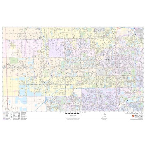
An interactive Pembroke Pines city Map shows street details with various landmarks, government buildings, schools, churches, highways (I-75, U.S-27, SR-25), and more. The map also mentions municipal, Town, and Zip code boundaries. The map also shows hospital campuses, postal districts, streets and neighborhoods, industrial areas, and recreation areas like parks, Golf courses, and much more.
Major infrastructure like airports, police stations, shopping malls, industrial complexes, train stations is also identifiable. A map legend featured at the bottom helps all the signs, characters, graphics, and symbols used throughout the map for a better explanation.
About Pembroke Pines, Florida
Pembroke Pines is a city in Southern Broward County, Florida, United States. The City is located 22 miles north of Miami. It is one of the principal cities in the Miami metropolitan area. The city has a total area of 34.8 square miles (90.2 km2), of which 33.1 square miles (85.8 km2) are land and 1.7 square miles (4.4 km2) (4.88 %) are covered by water, making it one of the largest cities in Broward County.
Surrounding Areas near Pembroke Pines, Florida
- Southwest Ranches
- Davie
- Cooper City
- Hollywood
- The Everglades
More Maps Of Florida Cities
More Information
| SKU | svd_fl_pembroke_pines_24 |
|---|---|
| Map Scale | 1:22k |
| Flat Size | 24 x 36 in |
Reviews
{{title}}
{{detail}}