Relief Map East Sheet (1906)
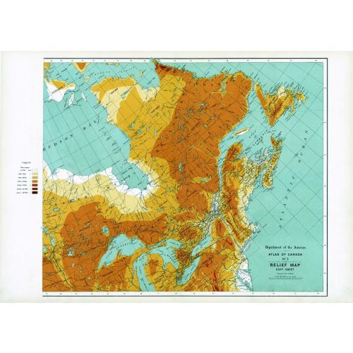
Contained within the 1st Edition (1906) of the Atlas of Canada is a map that shows the relief (in feet) for Eastern Canada. Depth of the elevation is proportional to the varying tints of brown. The highest elevations are shown in the darkest tints and lower portions in lighter tints. Relatively large areas of Western Canada had incomplete data on relief as of 1906. The map also shows major drainage divides and railways.
Details
Contained within the 1st Edition (1906) of the Atlas of Canada is a map that shows the relief (in feet) for Eastern Canada. Depth of the elevation is proportional to the varying tints of brown. The highest elevations are shown in the darkest tints and lower portions in lighter tints. Relatively large areas of Western Canada had incomplete data on relief as of 1906. The map also shows major drainage divides and railways.
More Information
| SKU | nrcan-294064-1 |
|---|---|
| Map Scale | 1:6,336,000 |
| Flat Size | 24 x 17.25 in |
| Publication Date | 1906 |
| Publisher Name | Natural Resources Canada |
Reviews
{{title}}
{{detail}}