Rome Map
Details
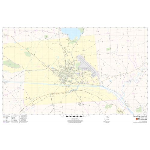
This map of Rome City, New York has been made with intricate details based on well-researched data. The map elaborates Municipal, town, and Zip code boundaries as well. Main Transportation routes (NY-26,NY-46, NY-49,NY-69 ) interlinking the cities of New York, USA are marked in the map with color-coded markings.
Major infrastructure like colleges, airports (Griffiss International Airport), police stations, shopping malls, industrial complexes, business-centric complexes, hospitals, train stations(Rome Amtrak station) is also identifiable. A map legend featured at the bottom helps all the signs, characters graphics, and symbols used throughout the map.
About Rome, New York
Rome is a city in Oneida County, New York, United States, located in the State. Rome is one of two principal cities in the Utica-Rome Metropolitan Statistical Area. Rome is in New York ’s 22nd congressional district. Rome is the second-Largest by area in New York State, the city has a total area of 75.7 square miles (196 km2)
Rome averages over 120 inches (3,000 mm) of snowfall each winter, mostly due to its proximity to Lake Ontario and the Lake-effect snow that it produces.
More Maps Of New York Cities
More Information
| SKU | svd_ny_rome_36 |
|---|---|
| Map Scale | 1:12,000 |
| Flat Size | 24 x 36 in |
Reviews
{{title}}
{{detail}}