D-Day - Omaha Beach - Normandy - Wall Map
Details
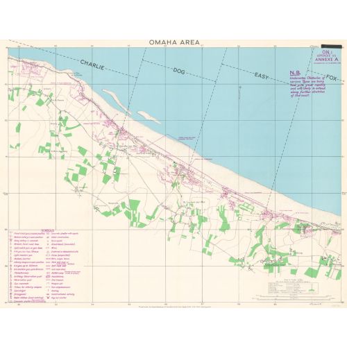
A D-Day map covering Charlie, Dog, Easy and Fox sectors of Omaha Beach and the towns of Vierville-sur-Mer, les Moulins and Colleville-sur-Mer. Includes Information up until April 6th, 1944, just 2 months to the day before the landings started. The Original Maps have been digitally scanned at high resolution in Full Colour.
More Information
| SKU | xyz-dday-omaha-1 |
|---|---|
| Flat Size | 30 x 23.25 in |
| Publication Date | 1944 |
| Publisher Name | XYZ Maps |
Reviews
{{title}}
{{detail}}
No reviews yet ...
Have an opinion? Help others decide. Share your knowledge about this product by submitting a review.
{{/items}}
{{#previousPage}}
Previous Page
{{/previousPage}}
{{#load-more-src}}
Next Page
{{/load-more-src}}
★★★★★
★★★★★