Isotherms for Months of Year (1906)
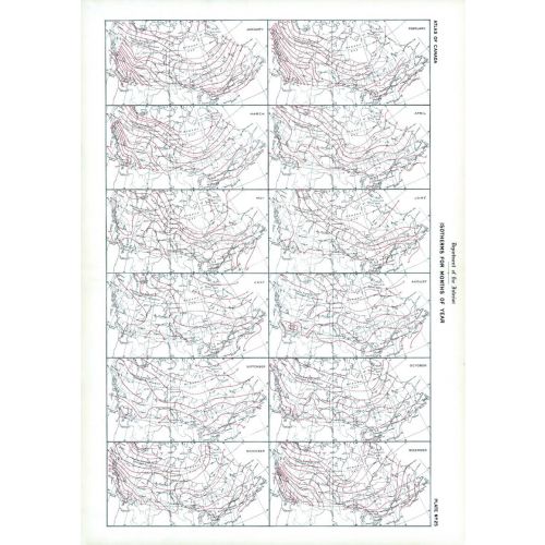
Contained within the 1st Edition (1906) of the Atlas of Canada is a plate that shows isothermal lines for each month of the year. Within the plate there are 12 maps, one for each month that varies from January to December. These lines are drawn at intervals of 5 degrees Fahrenheit connect the points having the same mean temperature. They are deduced from observations by the Meteorological Service extending over a series of years.
Details
Contained within the 1st Edition (1906) of the Atlas of Canada is a plate that shows isothermal lines for each month of the year. Within the plate there are 12 maps, one for each month that varies from January to December. These lines are drawn at intervals of 5 degrees Fahrenheit connect the points having the same mean temperature. They are deduced from observations by the Meteorological Service extending over a series of years.
More Information
| SKU | nrcan-294036-1 |
|---|---|
| Flat Size | 17.25 x 24.25 in |
| Publication Date | 1906 |
| Publisher Name | Natural Resources Canada |
Reviews
{{title}}
{{detail}}