India and Burma - Published 1946
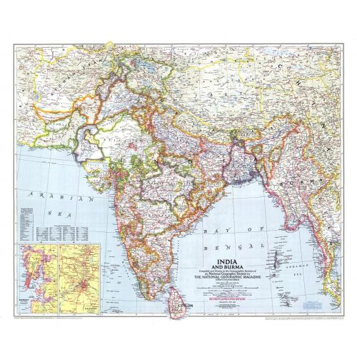
Published in April 1946 just a year before India and Pakistan gained their independence, this map of India and Burma details the numerous provinces of the region. Half of a two-map set, it accompanied the "Political Subdivisions of India" map and three articles on India.
Details
Published in April 1946 just a year before India and Pakistan gained their independence, this map of India and Burma details the numerous provinces of the region. Half of a two-map set, it accompanied the "Political Subdivisions of India" map and three articles on India.
More Information
| SKU | ngmaps-HM19460401-1 |
|---|---|
| Flat Size | 31.25 x 26 in |
| Publication Date | 1946 |
| Publisher Name | National Geographic |
Reviews
{{title}}
{{detail}}
No reviews yet ...
Have an opinion? Help others decide. Share your knowledge about this product by submitting a review.
{{/items}}
{{#previousPage}}
Previous Page
{{/previousPage}}
{{#load-more-src}}
Next Page
{{/load-more-src}}
★★★★★
★★★★★