Medieval England - Published 1979
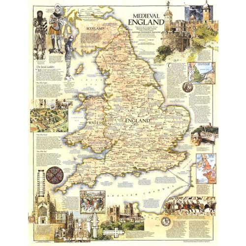
This map of Medieval England contains a wealth of historical information and sites as well as beautiful illustrations. Published in October 1979 as a companion to the modern map "British Isles".
Details
This map of Medieval England contains a wealth of historical information and sites as well as beautiful illustrations. Published in October 1979 as a companion to the modern map "British Isles".
More Information
| SKU | ngmaps-HM19791002-1 |
|---|---|
| Flat Size | 22.75 x 29.25 in |
| Publication Date | 1979 |
| Publisher Name | National Geographic |
Reviews
{{title}}
{{detail}}
No reviews yet ...
Have an opinion? Help others decide. Share your knowledge about this product by submitting a review.
{{/items}}
{{#previousPage}}
Previous Page
{{/previousPage}}
{{#load-more-src}}
Next Page
{{/load-more-src}}
★★★★★
★★★★★