Philippines - Published 1945
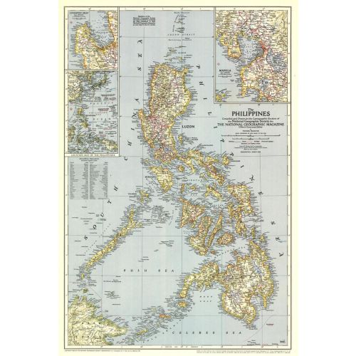
The Philippines were liberated from the Japanese by MacArthur's forces just months before this map was published in March 1945. This map, which accompanied the article "What Luzon Means to Uncle Sam," features the provinces and their capitals as well as airfields. A fine collectible for those interested in World War II era maps.
Details
The Philippines were liberated from the Japanese by MacArthur's forces just months before this map was published in March 1945. This map, which accompanied the article "What Luzon Means to Uncle Sam," features the provinces and their capitals as well as airfields. A fine collectible for those interested in World War II era maps.
More Information
| SKU | ngmaps-HM19450300-1 |
|---|---|
| Flat Size | 17.5 x 26 in |
| Publication Date | 1945 |
| Publisher Name | National Geographic |
Reviews
{{title}}
{{detail}}
No reviews yet ...
Have an opinion? Help others decide. Share your knowledge about this product by submitting a review.
{{/items}}
{{#previousPage}}
Previous Page
{{/previousPage}}
{{#load-more-src}}
Next Page
{{/load-more-src}}
★★★★★
★★★★★