Minerals, west sheet (1906)
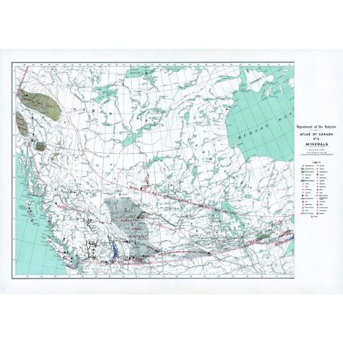
Contained within the 1st Edition (1906) of the Atlas of Canada is a map that shows the mineralogy and locations of mineral deposits for Western Canada circa 1906. A line drawn across the map indicates where the Northern, large portion of the Dominion is virtually unprosecuted except along the valleys of the principal rivers, including the Southern, partly prospected areas. Different symbols indicate which type of mineral is located in a specific location. The map includes major cities, rivers, major bodies of water, and some railway systems.
Details
Contained within the 1st Edition (1906) of the Atlas of Canada is a map that shows the mineralogy and locations of mineral deposits for Western Canada circa 1906. A line drawn across the map indicates where the Northern, large portion of the Dominion is virtually unprosecuted except along the valleys of the principal rivers, including the Southern, partly prospected areas. Different symbols indicate which type of mineral is located in a specific location. The map includes major cities, rivers, major bodies of water, and some railway systems.
More Information
| SKU | nrcan-223838-1 |
|---|---|
| Map Scale | 1:6,336,000 |
| Flat Size | 24 x 17.25 in |
| Publication Date | 1906 |
| Publisher Name | Natural Resources Canada |
Reviews
{{title}}
{{detail}}