North America - Published 1924
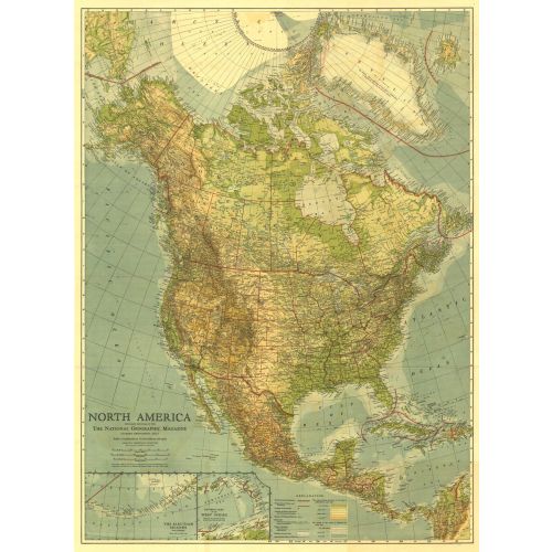
Published in May 1924, this beautiful map of North America is colored to indicate elevation and ocean depth, and features boldly drawn state, provincial, and international boundaries. Inset maps of the Aleutian Islands and the eastern part of the West Indies complete this attractive presentation of the region.
Details
Published in May 1924, this beautiful map of North America is colored to indicate elevation and ocean depth, and features boldly drawn state, provincial, and international boundaries. Inset maps of the Aleutian Islands and the eastern part of the West Indies complete this attractive presentation of the region.
More Information
| SKU | ngmaps-HM19240500-1 |
|---|---|
| Flat Size | 28 x 38 in |
| Publication Date | 1924 |
| Publisher Name | National Geographic |
Reviews
{{title}}
{{detail}}
No reviews yet ...
Have an opinion? Help others decide. Share your knowledge about this product by submitting a review.
{{/items}}
{{#previousPage}}
Previous Page
{{/previousPage}}
{{#load-more-src}}
Next Page
{{/load-more-src}}
★★★★★
★★★★★