Mexico and Central America - Published 2007
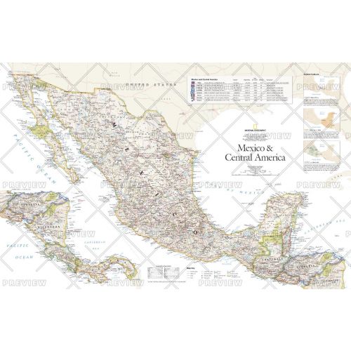
This vibrant political map of Mexico and Central America was published in August 2007 as half of a two-map set with a physical map of the country. Features country and state boundaries, cities, highways, airports, national parks, and information about each country including Guatemala, Belize, El Salvador, Honduras, Nicaragua, Costa Rica, and Panama.
Details
This vibrant political map of Mexico and Central America was published in August 2007 as half of a two-map set with a physical map of the country. Features country and state boundaries, cities, highways, airports, national parks, and information about each country including Guatemala, Belize, El Salvador, Honduras, Nicaragua, Costa Rica, and Panama.
More Information
| SKU | ngmaps-HM20070801-1 |
|---|---|
| Flat Size | 31.25 x 20.25 in |
| Publication Date | 2007 |
| Publisher Name | National Geographic |
Reviews
{{title}}
{{detail}}
No reviews yet ...
Have an opinion? Help others decide. Share your knowledge about this product by submitting a review.
{{/items}}
{{#previousPage}}
Previous Page
{{/previousPage}}
{{#load-more-src}}
Next Page
{{/load-more-src}}
★★★★★
★★★★★