North Carolina, South Carolina, Georgia and Eastern Tennessee Map - Published 1926
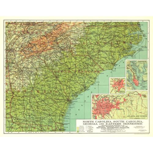
Published in September 1926, this map of North Carolina, South Carolina, Georgia and Eastern Tennessee highlights these southern states just over sixty years after major events of the Civil War took place including the burning of Atlanta. Inset maps of the cities of Atlanta, Charlotte, and Charleston provide greater detail of the region.
Details
Published in September 1926, this map of North Carolina, South Carolina, Georgia and Eastern Tennessee highlights these southern states just over sixty years after major events of the Civil War took place including the burning of Atlanta. Inset maps of the cities of Atlanta, Charlotte, and Charleston provide greater detail of the region.
More Information
| SKU | ngmaps-HM19260900-1 |
|---|---|
| Flat Size | 20 x 15.75 in |
| Publication Date | 1926 |
| Publisher Name | National Geographic |
Reviews
{{title}}
{{detail}}
No reviews yet ...
Have an opinion? Help others decide. Share your knowledge about this product by submitting a review.
{{/items}}
{{#previousPage}}
Previous Page
{{/previousPage}}
{{#load-more-src}}
Next Page
{{/load-more-src}}
★★★★★
★★★★★