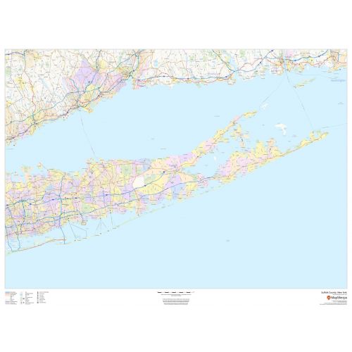
Suffolk County Map (New York)
Suffolk County Map shows regional level information that includes major roads, highways, neighborhood names, railways, high-level land use like parks, recreation areas, industrial areas, and hospital campuses. Major infrastructures like airports and train stations, tourist information, police stations, and shopping centers are also identifiable.
Details
Suffolk County, New York Map shows regional level info. like industrial areas, hospital campuses,neighborhood names, railways,Etc, Visit Online Store of Maptrove for more options
More Information
| SKU | dmsg-county-str-suffolk-NY-1 |
|---|---|
| Map Scale | 1:130,000 |
| Flat Size | 48 x 36 in |
| Publication Date | 2018 |
| Publisher Name | MapSherpa |
Reviews
{{title}}
{{detail}}
No reviews yet ...
Have an opinion? Help others decide. Share your knowledge about this product by submitting a review.
{{/items}}
{{#previousPage}}
Previous Page
{{/previousPage}}
{{#load-more-src}}
Next Page
{{/load-more-src}}
★★★★★
★★★★★
Related Products
Map of New York State
As low as
$21.99
Suffolk County ZIP Code Map (New York)
As low as
$39.99
Bronx County, New York Map
As low as
$38.99
Westchester County Map (New York)
As low as
$38.99
Albany ZIP Code Map, New York
As low as
$41.99
Amherst ZIP Code Map, New York
As low as
$41.99
Amsterdam ZIP Code Map, New York
As low as
$41.99
Auburn ZIP Code Map, New York
As low as
$41.99
Astoria ZIP Code Map, New York
As low as
$41.99
Greater New York - Published 1964
As low as
$19.99
Kings County Map (New York)
As low as
$38.99
New York County Zip Code Map, New York
As low as
$38.99
Queens County Map (New York)
As low as
$38.99