Superior Map
Details
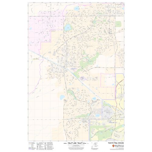
The highly detailed Superior Town Map highlights Municipal, Town, and Zip code boundaries. The major roads and highways(US Route 36, SH 128, SH-170), lakes, recreational parks are easily identifiable on the map.
A map legend at the bottom helps identify all signs and symbols used on the map. Infrastructures such as hospitals, shopping malls, exhibition centers, industrial complexes, airports, and other business-centric features can be identified in the map. The customizable map is available in various sizes, landscape, and portrait orientation and various premium finishes.
About Superior, Colorado
Superior is a Statutory Town located in Boulder County,Colorado , United States With a small, uninhabited segment of land extending into Jefferson County. Superior is located at 39.56’N 105.10” W. The Superior Town has a total area of 4.01 Square miles(10.38 km2) of which land is 3.97 Square miles(10.28 km2). The Zip code of the City is 80027. The area code of the Town are 303 and 730.
Neighborhoods in Superior, Colorado
Some of the popular neighborhoods in Superior Town, Colorado are:
- Superior Village
- East End
- Billings Park
- Barker’s Island
- Allouez
More maps
More Information
| SKU | svd_co_superior_24 |
|---|---|
| Map Scale | 1:11k |
| Flat Size | 24 x 36 in |
Reviews
{{title}}
{{detail}}