Columbus Zip Code Map, Ohio Zip Codes
This map is available in a scale of 1:50,000 in 36 x 48 inches in portrait orientation. If you want a map with different extents, or landscape orientation, or scale, you can do that by customizing the map here. If you have any questions, we will be happy to answer over the phone (866) 525-2298 or write to us
Details
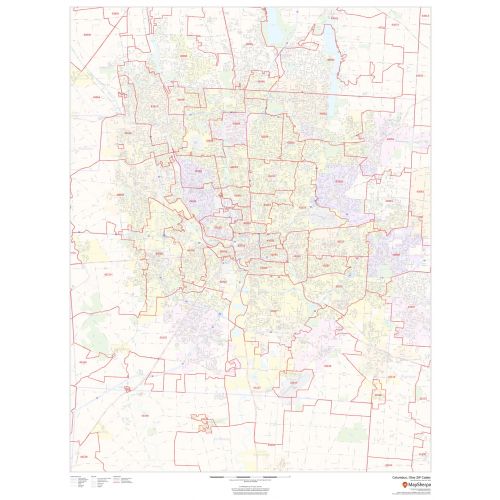
Columbus Ohio Zip Code Map
This is a detailed Columbus Zip Code map that marks all Zip Code boundaries and street-level information about the city. You will also find extensive geographic details like roads, highways, neighborhood names, railways and high-level land use on this map. The map includes a map legend that comes handy while reading different signs and symbols used throughout the map. You can purchase this high-quality map in a variety of finishing materials like paper, matte plastic, and lamination.
How can you use this map?
The map is ideal for day to day business functions of tracking down delivery service areas, sales territories, and catchment areas. You can also plan direct mail marketing services using this map or simply hang it on the walls of your home or office.
How to customize this Columbus Zip Code map?
You can buy a customizable version of this map at our online map store. That map gives a more accurate print of your business service area, sales territory, or your neighborhood in the city. You can zoom-in that map to get a closer look at the streets and roads of Columbus. You can center the map on any location, crop that area, and choose an orientation, paper sizes and paper finish of your choice.
Start editing this custom map of Columbus here.
More maps of Columbus
- Central Columbus Map - Portrait - Detailed map of central Columbus, available 36 x 48 inches.
- Central Columbus Map - Landscape - High-quality map of central Columbus, available in 48 x 36 inches.
More Information About Columbus
The city of Columbus is the state capital and the most populous in the U.S. state of Ohio. It has an estimated population of 892,533, making it is the 14th-most populous city in the US and one of the fastest-growing cities in the nation. The city is also the county seat of Franklin County and is named after its explorer Christopher Columbus.
The diverse economy of the city is based on education, government, insurance, banking, defense, aviation, food, clothes, logistics, steel, energy, medical research, health care, hospitality, retail, and technology. Its metropolitan area is home to the Battelle Memorial Institute, the world's largest private research and development foundation.
What are the Zip Codes in Columbus?
There are more than 40 Zip Codes in the city, all of which have a prefix of 430xx and 432xx. These range from 43035, 43004, 43085, 43201 to 43207, 43209 to 43224, 43226 to 43232, 43234 to 43236, 43240, 43251, 43260, 43266, 43268, 43270 to 43272, 43279, 43287, and 43291.
These Zip Codes are maintained for mail delivery purposes and are also used for monitoring statistics, direct mail marketing, internet routing, and credit card security.
Neighborhoods in Columbus
The city doesn't have any defined neighborhoods. The areas often overlap and vary in size. Most large neighborhoods integrate the smaller ones and the modern interpretations of the borders vary as many historical neighborhoods, villages, and towns have been annexed and absorbed by the city of Columbus.
The downtown region of the city is the CBD area that centers on the intersection of Broad and High streets, with the northeast corners being known simple as Broad & High by the surrounding businesses and media. It encompasses all the area inside the inner belt and is home to most of the largest buildings in Columbus.
More Information
| SKU | dmsg-zip-columbus-1 |
|---|---|
| Map Scale | 1:50,000 |
| Flat Size | 36 x 48 in |
| Publication Date | 2018 |
| Publisher Name | MapSherpa |
Reviews
{{title}}
{{detail}}