Waco Map
Details
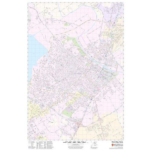
This map of Waco City has been designed with accuracy based on well-researched data. The map highlights Municipal, town, and ZIP code boundaries.
Transportation routes ( I-35, I-, U.S-77, U.S-84, SH-77) interlinking the cities of Texas, the USA is marked neatly in the map with color-coded markings. Major infrastructure like colleges, airports, police stations, shopping malls, industrial complexes, hospitals, train stations, recreation parks, lakes(lake Waco) is also identifiable.
About Waco, Texas
Waco is a city in central Texas and is the county seat and largest city of Mclennan County, Texas, United States. It is situated along the Brazos River and I-35, halfway between Dallas and Austin, and is a part of the Macon Metropolitan Statistical Area. The ZIP code of the city ranges from 76700-76799 and the area code is 254.
Neighborhoods in Waco, Texas
Waco is first divided into three ”sides”, the North Side, the South Side, and the East Side and Downtown Waco. Each side is then broken up into different sectors, or neighborhoods.
More maps of Texas Cities
More Information
| SKU | svd_tx_waco_24 |
|---|---|
| Map Scale | 1:21,000 |
| Flat Size | 24 x 36 in |
Reviews
{{title}}
{{detail}}